
From Brooklyn to Antarctica from a Hellish Experience to Heaven
January 10, 2026
I boarded American Flight 2441 from Laguardia to Dallas.
We departed on time, but after taxiing about short distance, we returned to the gate because of an acrid smell on the plane.
After spending over an hour switching to another plane, we took off and flew for about 20 minutes. The plane became unbearably hot and the captain diverted the plane to Philadelphia airport. He said that this was horrendous and that in all his years as a pilot, this had never happened to him before.
The bright spot was that I was rebooked in Premier class on a nonstop flight from JFK to Auckland. It was really comfortable. I had to purchase a new ticked on Air New Zealand and I was quickly on my way to Dunedin on the South Island.
Unfortunately, my suitcase didn’t make it to Dunedin. It sat at DFW for four days and at AKL for four days before finally making it to Dunedin on the day after we left on the ship. I had to purchase all new clothing and gear for Antarctica.
Wednesday, January 14, 2026
I arrived in Dunedin and finally met up with my friends Kim and Lester. After dropping off my daypack in my room we headed out for coffee and breakfast. We quickly found Perc. The barista there made me a fabulous flat white and breakfast. I had breakfast there every day.
While sitting there, we heard a pop that sounded like a car running over a soda bottle. Actually, someone had hit the front fender of a parked car. I went over to talk to the driver who was parked and we struck up a conversation. After a few minutes, he invited all three of us to dinner at his home that evening.
He picked us up and gave us a tour of the three hill of Dunedin. Many of the homes are very beautiful and they remind me of homes in San Francisco as did the hills.
Please donate to the New Zealand based Antarctic Heritage Trust. They care for the historic Ross Island Huts where Shackleton, Scott, and others overwintered. Website: NZANHT.ORG
Saturday, January 17, 2026
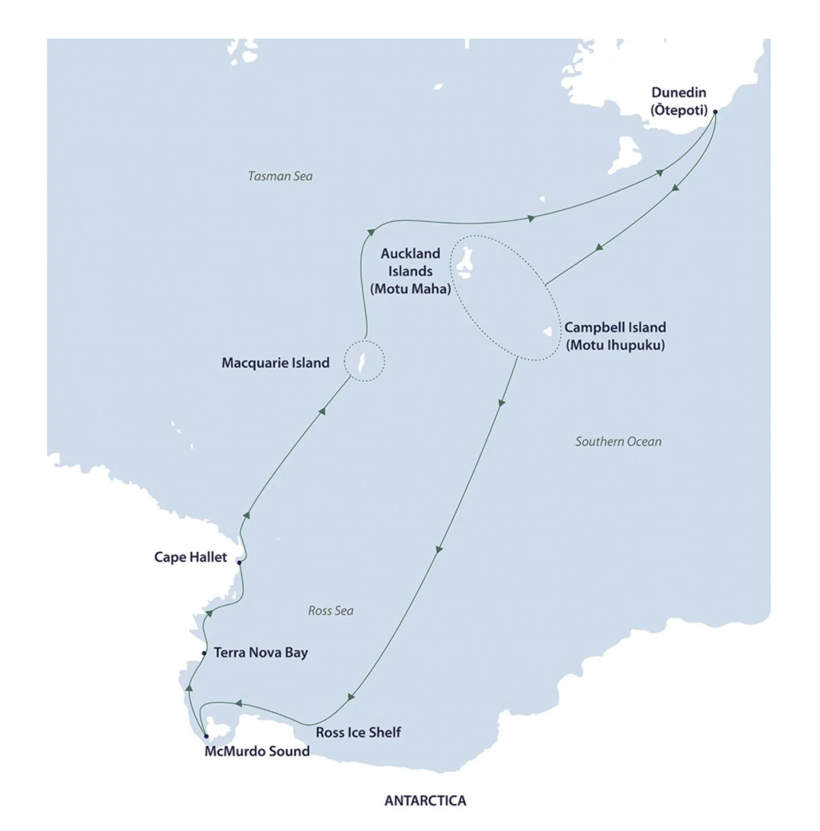
We departed from Dunedin on the MV Douglas Mawson at about six pm and started our long journey to the Ross Sea and McMurdo Sound in Antarctica.
Sunday, January 18, 2026
At sea.
Monday, January 19, 2026
We landed at Sandy Bay, Enderby Island, Auckland Islands. We had a wonderful walk up. and across the top of the island. There was so much to see including fur seals and yellow-eyed penguins that were far inland, Royal allbatross, the Rata forest. The vistas of the sea and clouds were also grand to see.
Tuesday, January 20, 2026
In the morning, we did a hike from the Musgrave Inlet, Auckland Islands,
In the afternoon, we did a zodiac tour starting at Carnley Harbor, Auckland Islands. We entered large caves on the zodiac with beautifully colored geologic structures and the shoreline rocks covered with bull kelp. The roofs of some of the caves had collapsed leaving moss and lichen covered root structures from the Rata forest above.
Wildlife was also plentiful including rock-hopper penguins and albatross.
Wednesday, January 21, 2026
We did a zodiac tour starting at the North Cape of Campbell Island. It was quite a long tour and we saw more caves, two waterfalls, a sea stack, a few Gray-Headed Albatross among hundreds of Royal Albatross.
In the afternoon we did a long, climbing hike starting at Perseverance Harbor on Campbell Island. I went about two thirds of the way which was still about 4 1/2 miles. The landscape was quite ethereal in the fog and mist.
In the evening, the ship departed from Campbell Island on our long crossing to the Ross Sea and McMurdo Base in Antarctica. It’s about 1750 miles, 1400 nautical miles, and 2800 kilometers to McMurdo.
Saturday, January 24, 2026
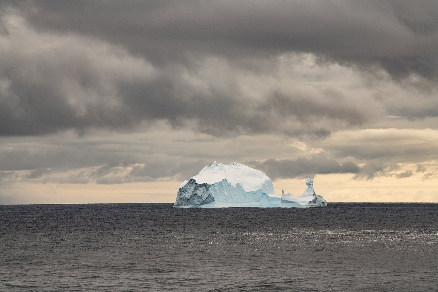
This is our third day in open seas and for the first time there is actually a swell that you can feel. We should reach the pack ice and the Ross Sea on January 25th. Yesterday, we saw our first iceberg in the distance. It wasn’t very large, but we haven’t seen another since then.
Yesterday, at noon at 60 degrees south, we crossed the Antarctic Convergence and entered the Southern Ocean. It was named as the fifth ocean by the International Hydrographic Organization (IHO) in 2000, but the National Geographic Society National Geographic officially added it to their maps on World Oceans Day, June 8, 2021.
Key details regarding its recognition include:
Geographical Definition: The Southern Ocean is defined by the Antarctic Circumpolar Current (ACC), not by continental boundaries.
IHO Recognition: In 2000, the IHO published a draft 3rd edition of "Limits of Oceans and Seas" which officially delimited the Southern Ocean, though it has not been universally ratified.
Alternative Names: Historically, this area was sometimes referred to as the Antarctic Ocean or the Great Southern Ocean.
Scientific Recognition: The ocean is considered the youngest, with the current forming around 34 million years ago.
Although some international agreements are still pending, it is widely recognized by scientists, the U.S. National Oceanic and Atmospheric Administration (NOAA) (as of February 2021), and cartographers as a distinct body of water.
Five Things You Should Know About the 'New' Southern Ocean
16 Apr 2024 — But scientists have long recognized a fifth ocean, called the Southern Ocean. In 1937, the body of water surrounding Antarctica wa...
Southern Ocean - The World Factbook - CIA
24 Nov 2023 — In 2000, the International Hydrographic Organization delimited the waters within the Convergence as a fifth world ocean - the Southern Ocean
Is there a Southern Ocean? Well, depends on who you ask! In 1999, the U.S. Board on Geographic Names officially recognized the Southern Ocean, extending from Antarctica’s icy coastline all the way to 60° South latitude. It surrounds the frozen continent and links the Pacific, Atlantic, and Indian Oceans through the powerful Antarctic Circumpolar Current.
In 2000, officials proposed the name “Southern Ocean” to the International Hydrographic Organization, but not every country agrees on boundaries—so it remains ambiguous under international law. NOAA began using the term in 1999 and formally recognized it in February 2021. The National Geographic Society followed in June of that year. “From the Southern Ocean” Randie Bundy, Brian Guest, and Carin Ashjian/WHOI
23 May 2025 — The Southern Ocean is a unique and vital region of the planet. It was officially recognized by the U.S. Board on Geographic Names.
Last night it never got totally dark and today, we should cross the Antarctic Circle and have twenty-four hours of daylight for at least the next 10 days.
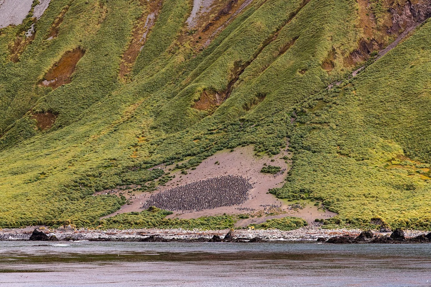
Yesterday, five days at sea after leaving McMurdo Sound and the Ross Sea, we arrived at Sandy Bay, Macquarie Island, Australia. We had an incredible siting of hundreds of thousands of Royal Penguins as well as a smaller number of King Penguins. Both the wildlife and the landscapes were wonderful.
The time zone changes here are crazy. One minute we’re on NZ time and another were two hours behind on E. Australian time.
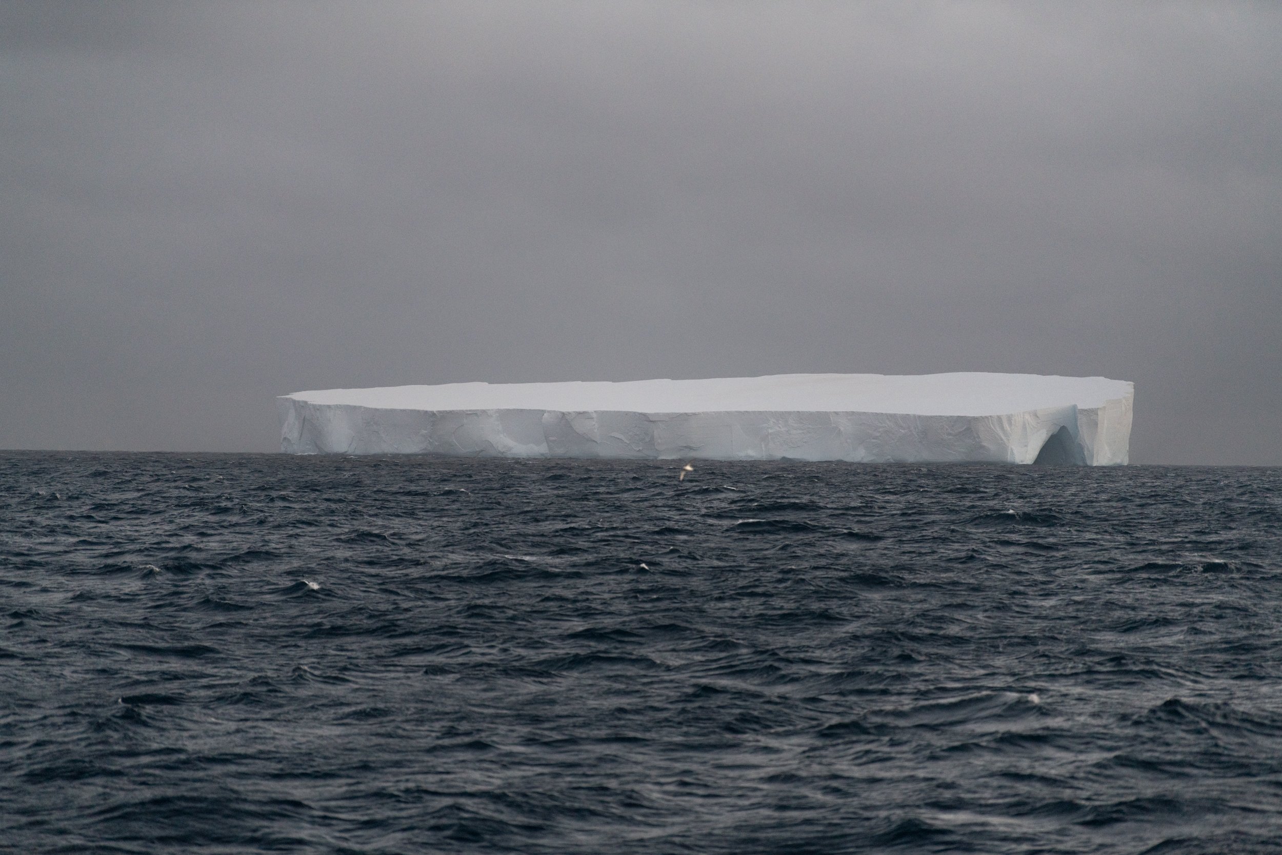
First large tabular iceberg seen at 2:04 am on January 25, 2026
Iceberg B-22A, 29 by 25 Nautical Miles, 33.35 miles by 28.75 miles, 54.32 x 46.27 km. It’s just enormous.

Still looking at B-22A; it seems to go on forever. And in the far distance, I see what I think is the pack ice but it could be another enormous iceberg. We’ll see later which it is.
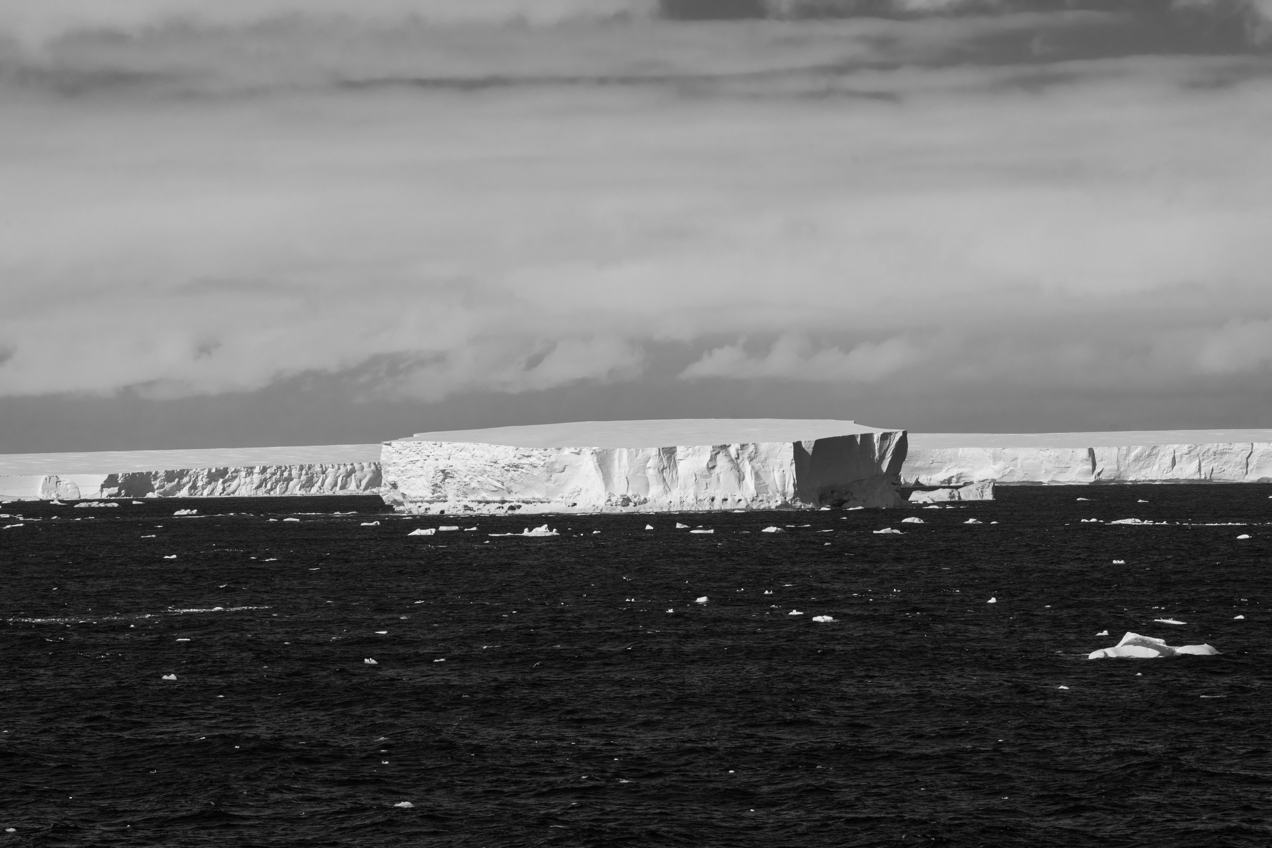
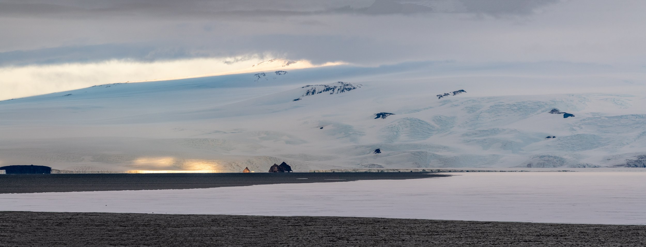
Admiralty Mountains with pack ice and Ross Sea in foreground, Trans Antarctic Range, Antarctica.
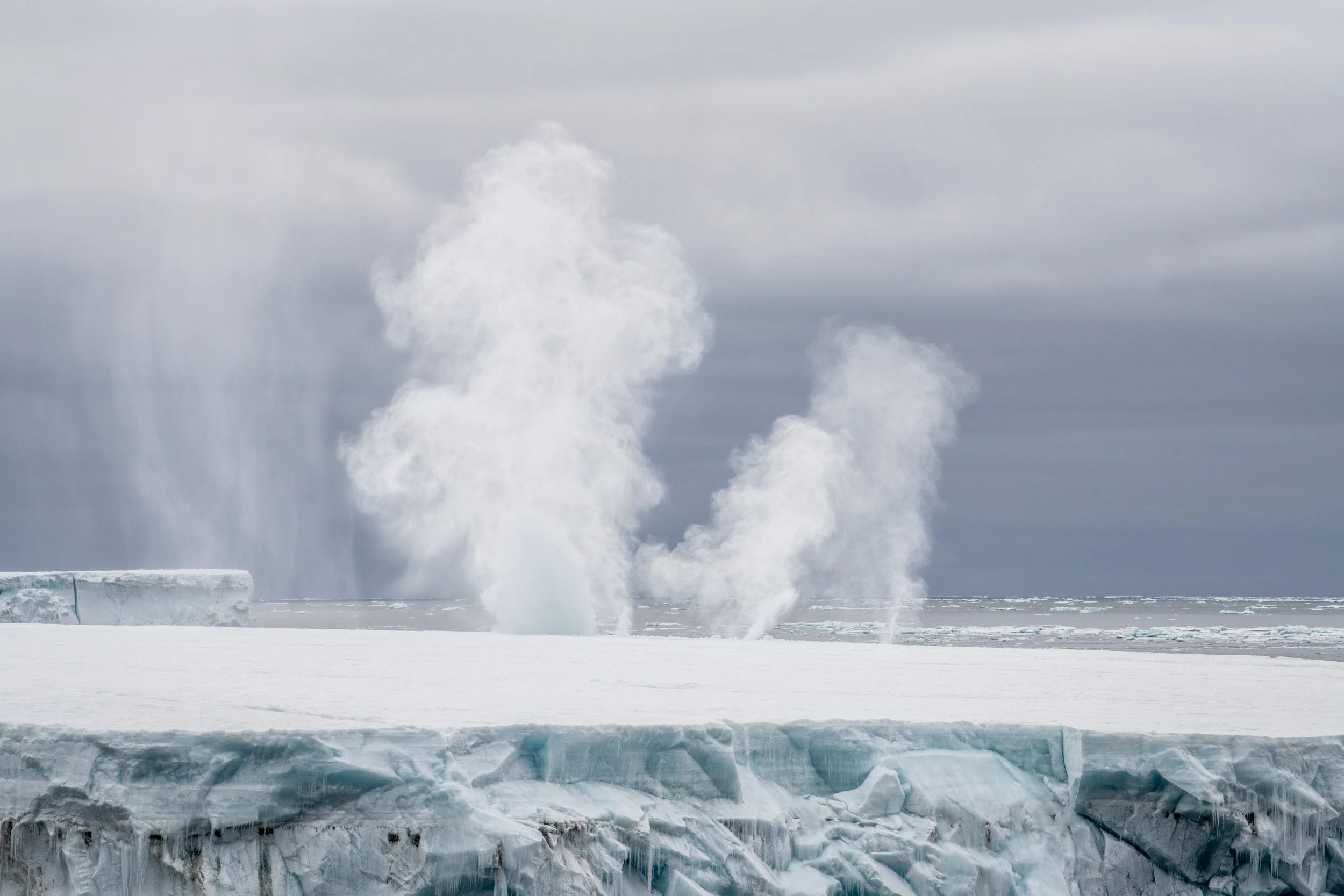
Blow hole, near Cape Adare; it’s a hole in the top of the iceberg and when a wave hits, it sends spray way up in the air.
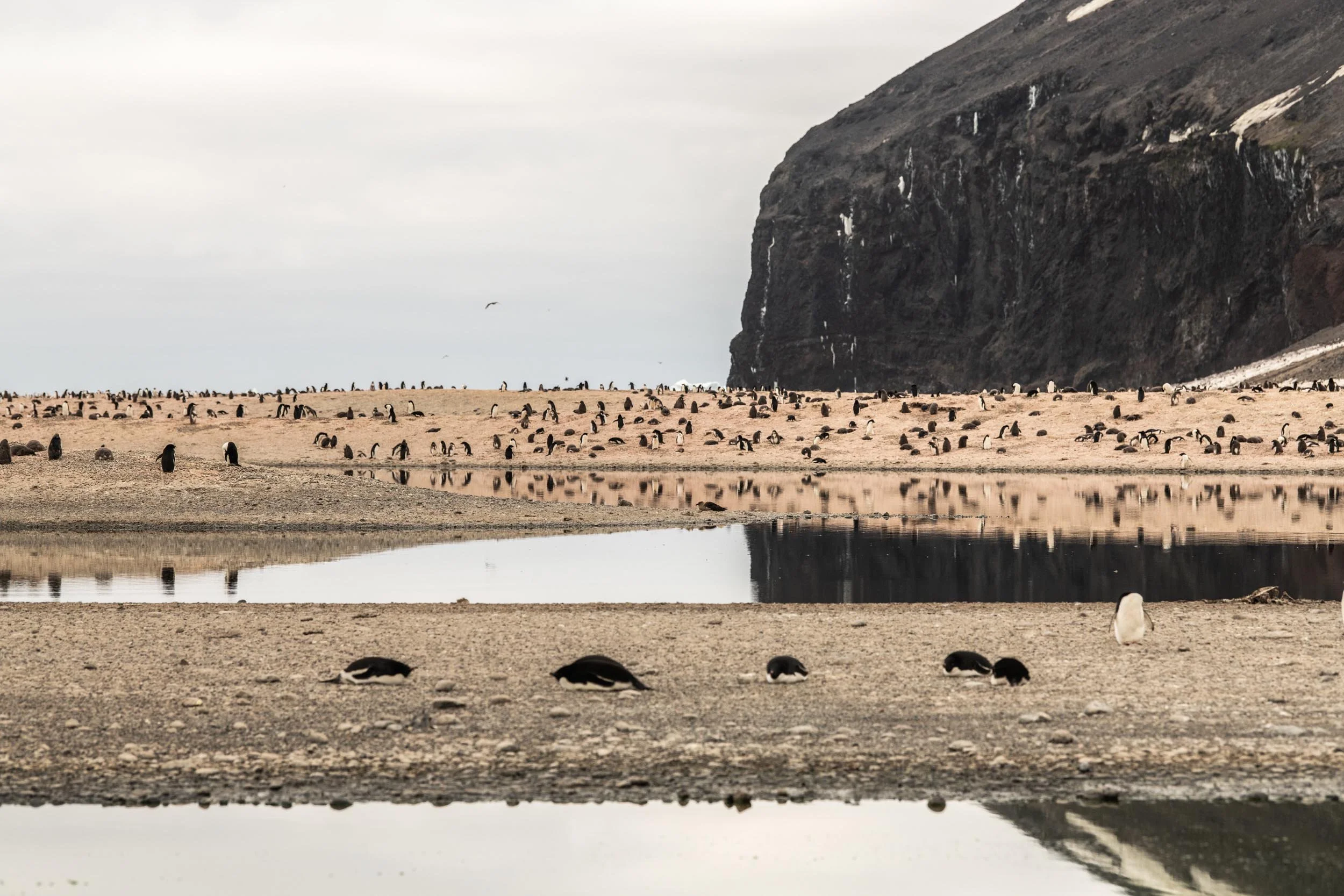
Adélie penguins at Cape Adare, Ross Sea, Antarctica, January 26, 2026. There are about 350,000 Adelies at Cape Adare.

Adélie penguins are so friendly. They will come right up to you and then go on about their business.
January 27, 2026
After almost 4 days at sea, yesterday there was so much to see. My friend, Lester calculated that the glacier we saw yesterday, designated, Iceberg B-22A, 29 by 25 Nautical Miles, 33.35 miles by 28.75 miles, 54.32 x 46.27 km. is about 10 to the 13th power of cubic meters of ice. We may calculate its mass further along.
We also saw saw two small huts at Cape Adare, Borchgrevink’s and the remains of Scotts northern party hut.
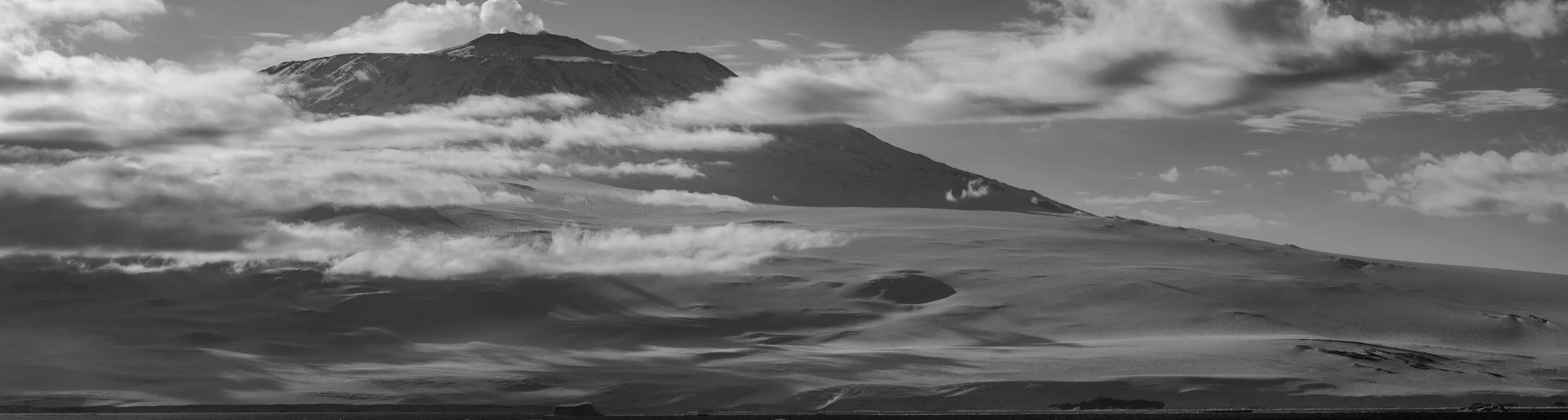
Mt. Erebus sending erupting, sending puffs of smoke into the sky
An even closer view of Mt. Erebus sending up puffs of smoke.

The inside and outside of Shackleton’s Hut on Ross Island, Ross Sea, Antarctica, January 28 2026. They overwintered in the hut.
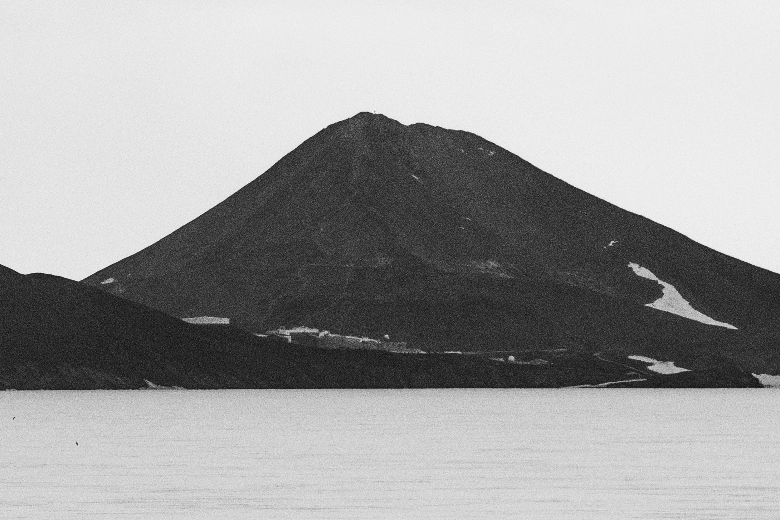
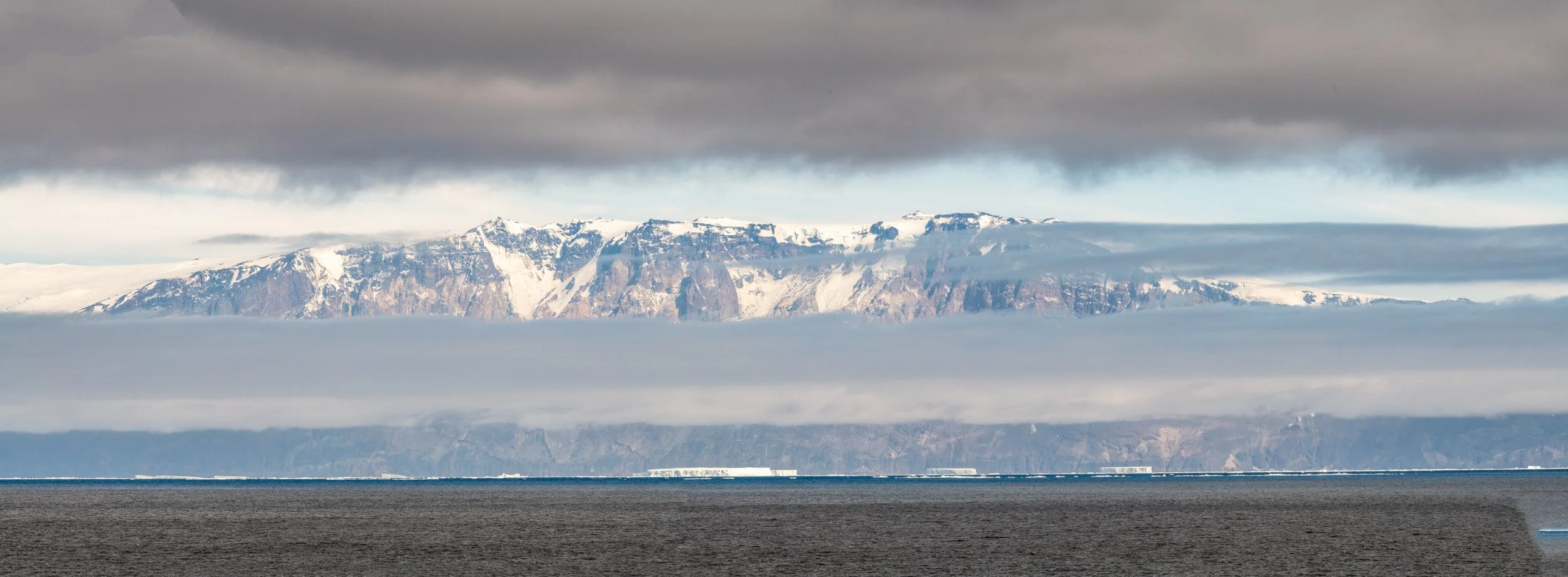
We are now at the furthest south of the trip at -77.7530 S, 166.2200 E. The buildings in the distance are at McMurdo Base, the largest United States research and logistics center in Antarctica. I was very exciting to see it. There was no sign of the USCGC icebreaker Polar Star. The ship keeps the channel open to McMurdo.
Pack ice, Southern Ocean and Mountains near McMurdo Base, Antarctica, January 29, 2026.
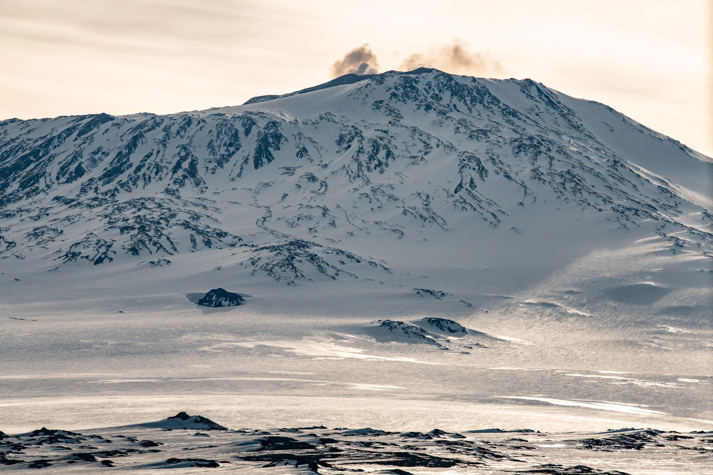
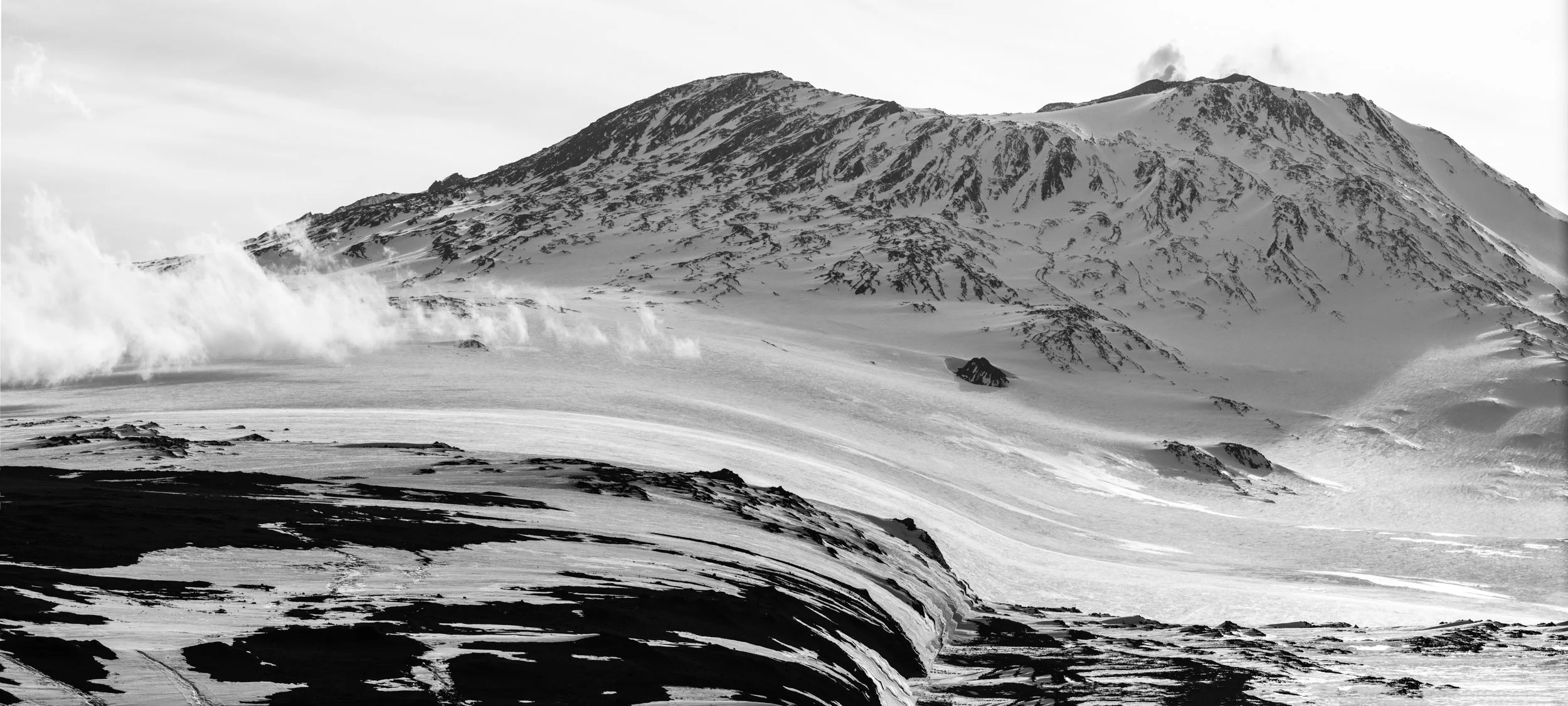
Steam venting from the cauldron of Mt. Erebus, Wednesday, January 28, 2026.
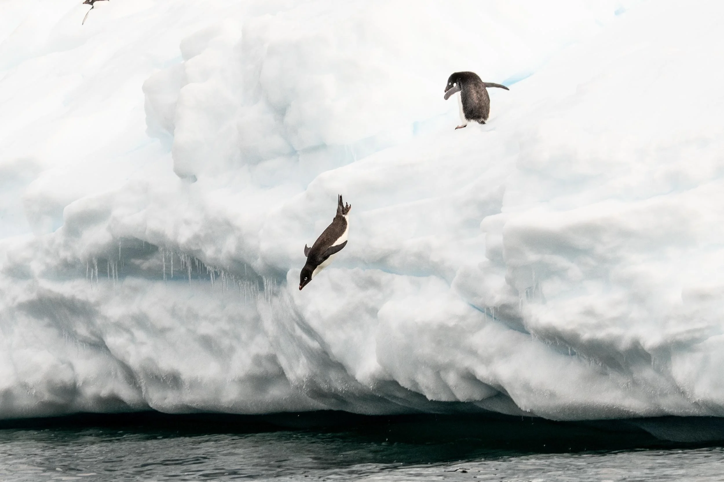
Adélie penguins jumping off a berg, Cape Bird, Ross Island, Antarctica, January 29, 2026.
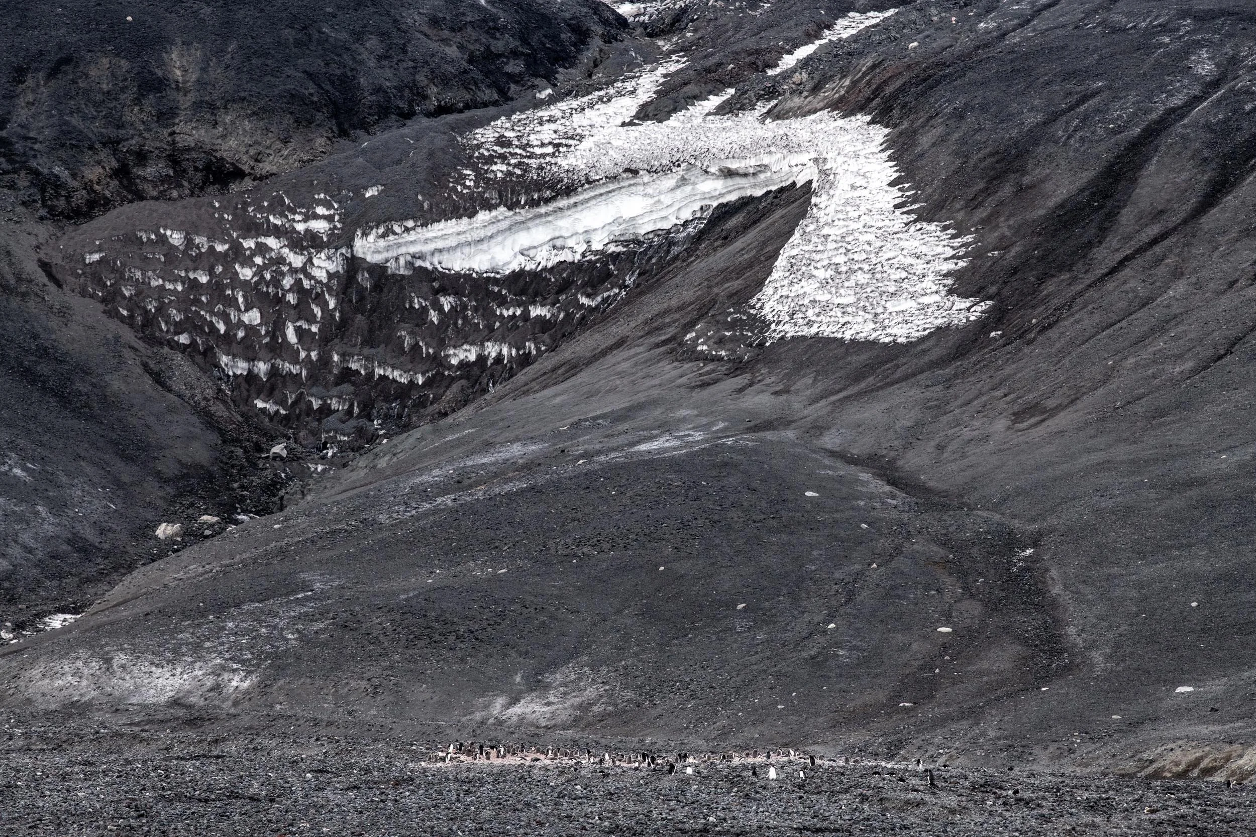
Part of a huge Adélie penguin colony on Cape Bird, Ross Island, Antartica, January 29, 2026.
Part of a huge Adélie penguin colony, Ross Island, Antarctica, January 29, 2026.
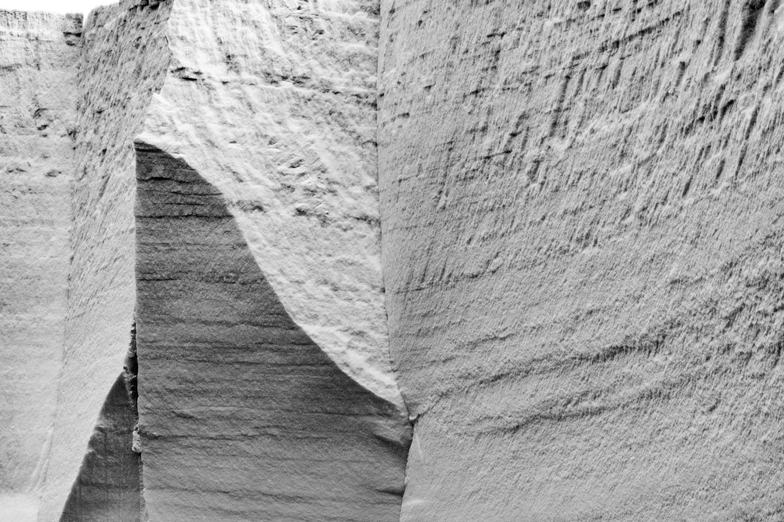
Angular ice on an iceberg near Cape Bird, Ross Island, Antarctica, January 29, 2026.
Angular ice on an iceberg near Cape Bird, Ross Island, Antarctica, January 29, 2026.
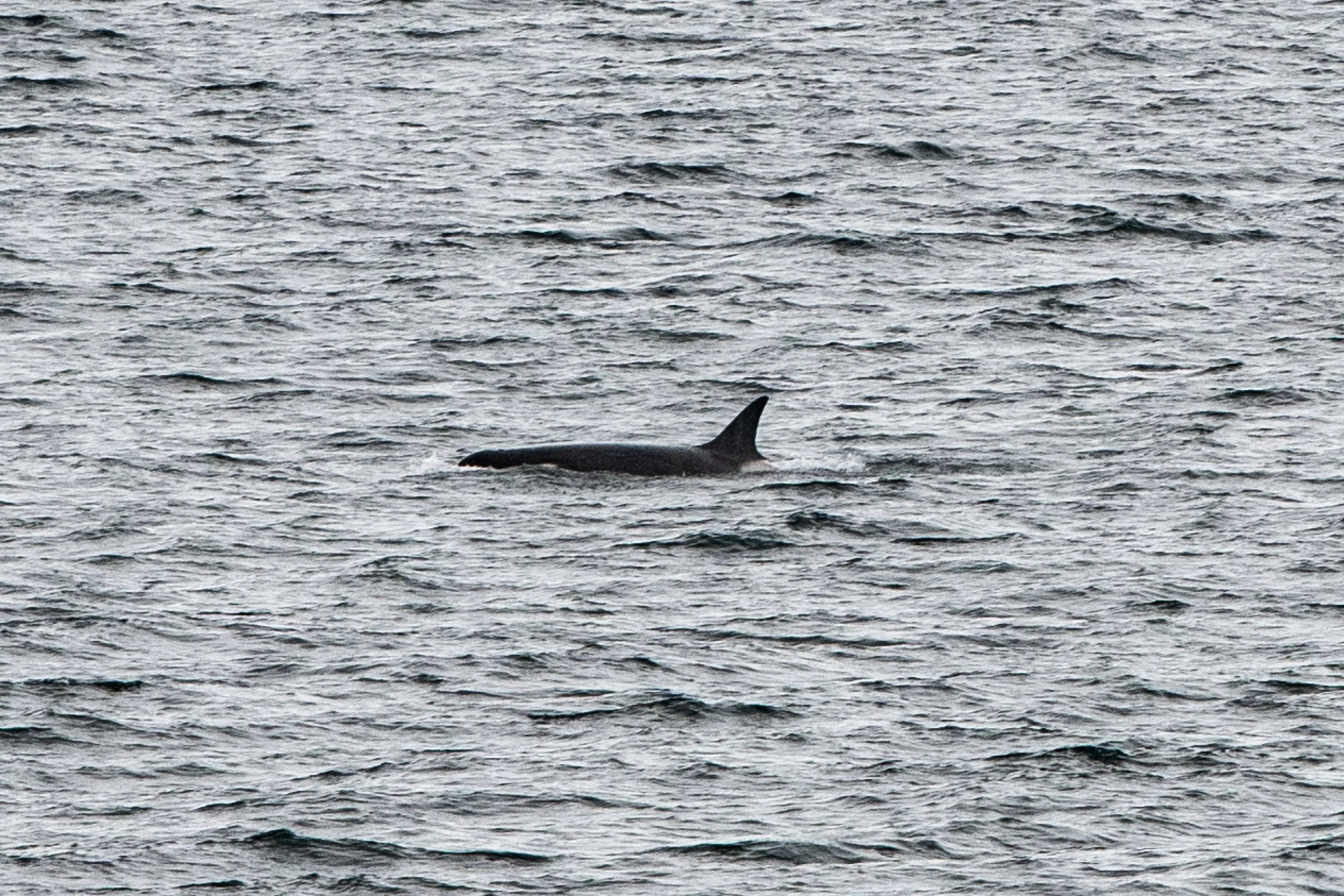
Orca near Cape Bird, Ross Island, Antarctica, January 29, 2026.
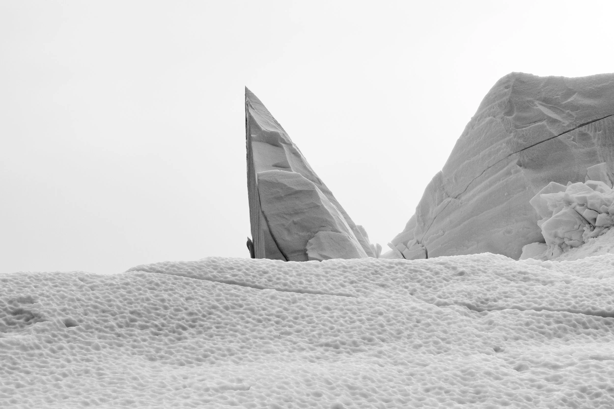
One of the last icebergs we saw on the trip. It’s is a really interesting shape.
King Penguins, Macquarie Island, Australia.
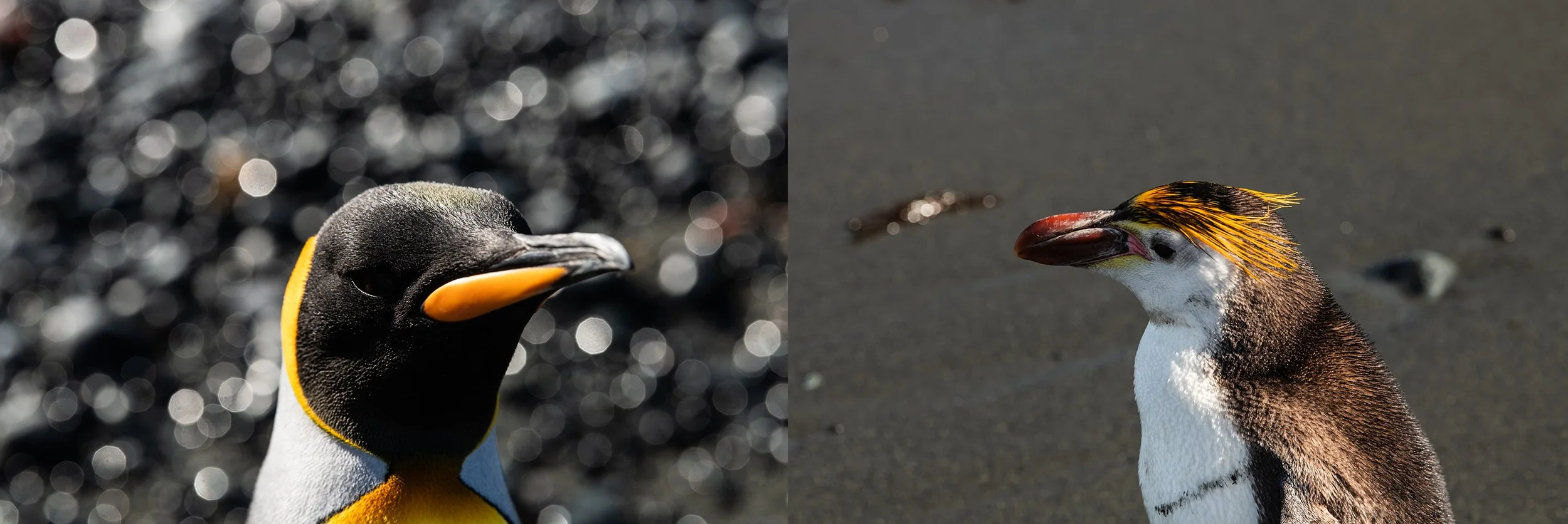
Left: King Penguins, Right: Royal Penguins, Macquarie Island, Australia.
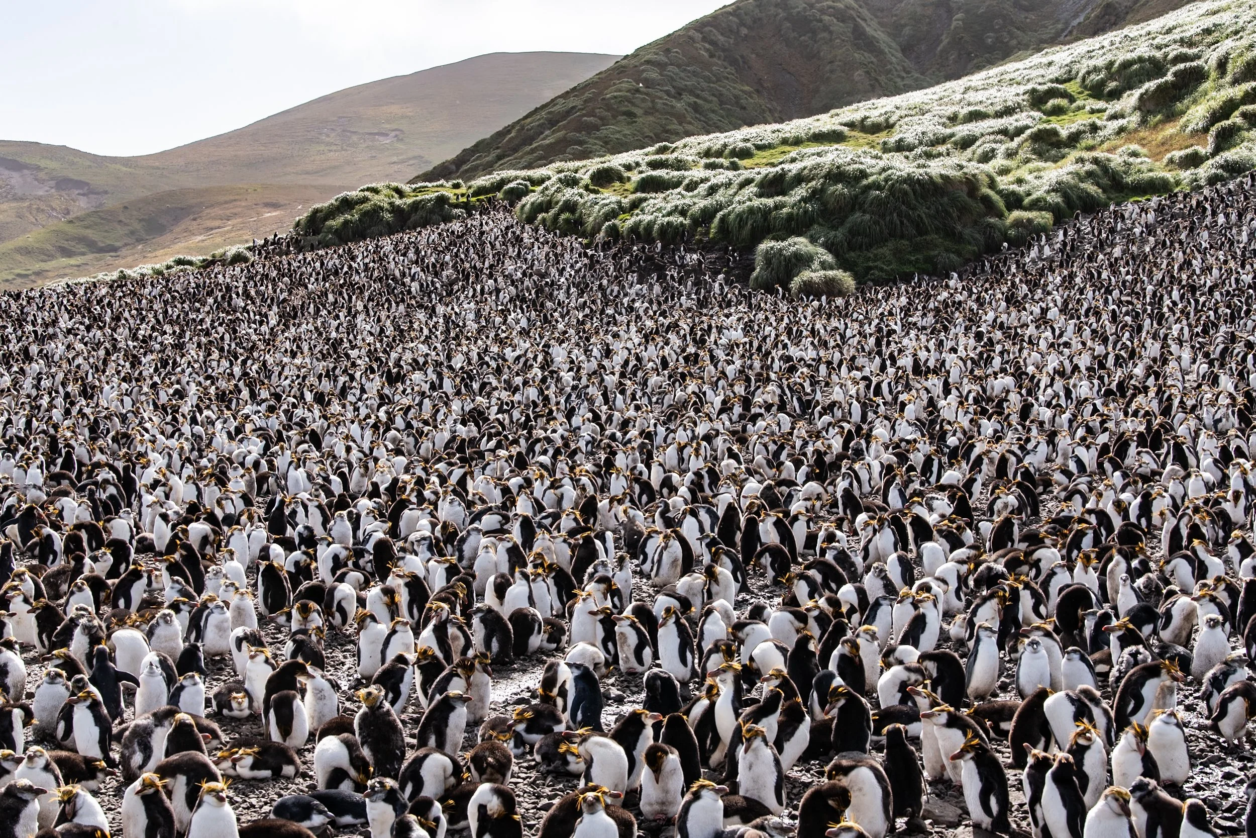
Tens of thousands of Royal Penguins, Maquerie Island, Australia, February 4, 2026.
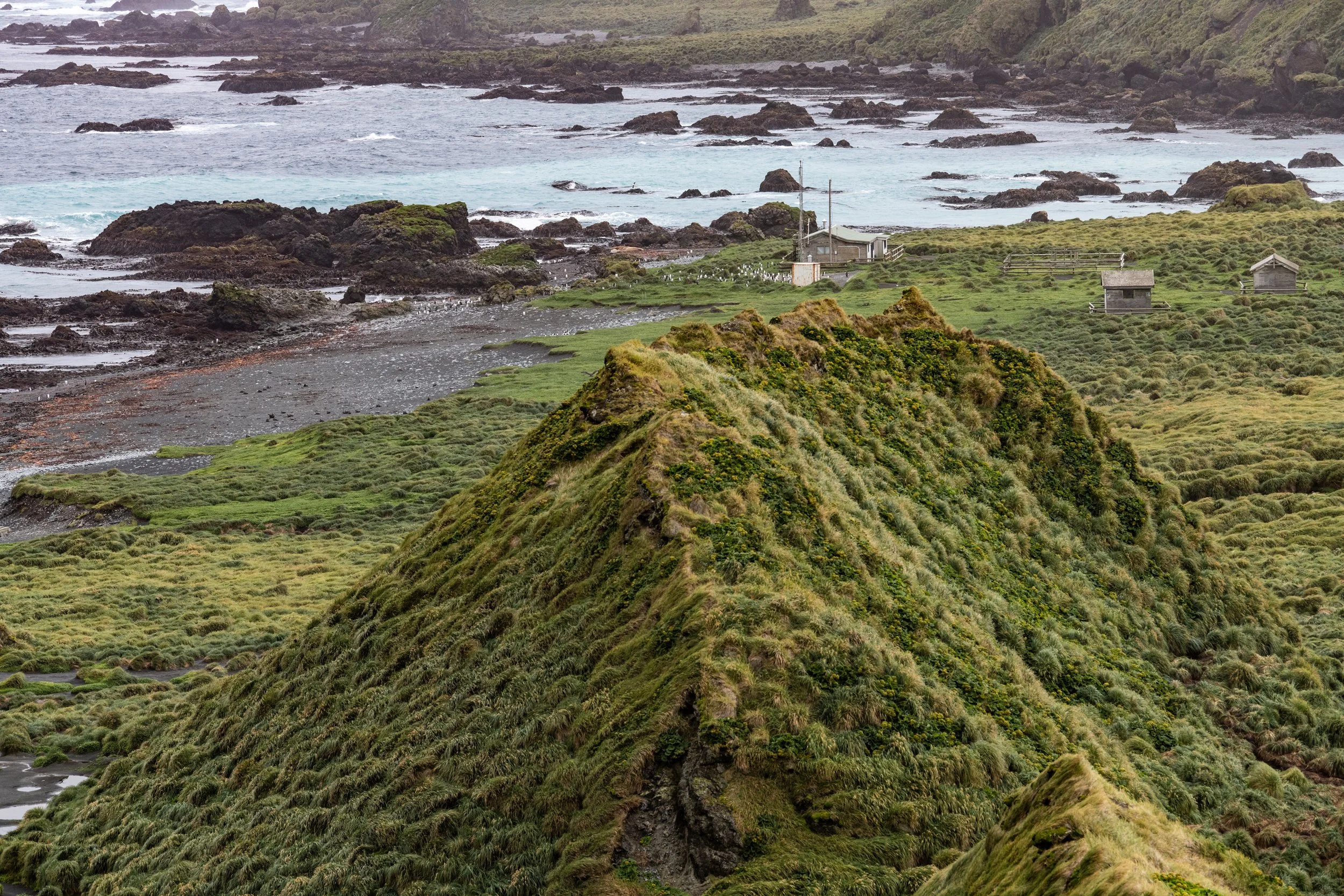
Sharp ridge liine, with research station in background, sea and rocks. Macquarie Island has outstanding universal value for two reasons. First, it provides a unique opportunity to study, in detail, geological features and processes of oceanic crust formation and plate boundary dynamics, as it is only place on earth where rocks from the earth’s mantle (6 kilometres below the ocean floor) are being actively exposed above sea level. These unique exposures include excellent examples of pillow basalts and other extrusive rocks. Second, its remote and windswept landscape of steep escarpments, lakes, and dramatic changes in vegetation provides an outstanding spectacle of wild, natural beauty complemented by vast congregations of wildlife including penguins and seals.
From Aurora Expeditions Itinerary